
 |
| San Agustin Archaeological park |
Excerpt from Cadogan Guides: The Spanish chronicles of the 17th century talk about the area around the village of San Agustin in some detail. They speak of the settlement of the land, of the fertile soils and valuable minerals to be found, of building roads and a chapel, and of other administrative details. But, strangely enough, not one mention is made of the sculptures. What had happened to them? Had they been buried and hidden? Or did the Spaniards, with more important matters at hand, simply ignore them? Perhaps there are some as yet undiscovered sheets, yellowing in the archives of a Colombian convent, which hold the very first eyewitness account of San Agustin's sculptures. It seems possible: the earliest record of the site was found only recently, in the public library of Palma de Mallorca, in Spain. The strange story that the crisp but faded parchments told, runs as follows.

In 1758 a lone Franciscan priest, Friar Juan de Santa Gertrudis, whose Amazon mission was facing many difficulties, decided to cross the Eastern Cordillera and to travel to Santa Fe in order to appeal to the Spanish Viceroy for help. Accompanied by a few missionized Andaki Indians, the friar ascended the eastern flanks of the Andes and reached the headwaters of the Magdalena river at San Agustin, then only 'a village of no more than five miserable huts'. There were few people to welcome the traveler, but among them happened to be another cleric from Popayan who had established a small mission at San Agustin. The reason for his mission was to become clear during the hearty meal that the cleric cheerfully offered to the tired friar.

Over coffee, the cleric confided to Friar Juan that he was an inveterate treasure hunter, and that, with Indian help, he had been digging for buried gold amongst the ruins and monuments he had found scattered in the vicinity of the village. He continued to speak at length about the strange burial sites, and revealed that while his men had already dug out 19 tombs, they had so far only found one gold earring. His grave-robbing had not as yet proved very successful.

Friar Juan listened in amazement. And the next morning, while his Indian escorts were still asleep after a night of merrymaking, he set out to see for himself. He was troubled by what he saw: '
There are three bishops...all of stone...with their mitres. They are dressed in their rochets which are fringed with lace, well-worked and beautiful. Only one has arms, but one can see that the left held a bishop's croizier while with the right he was giving his blessing...From there I went to see another monument...They were five Franciscan Friars of the Observant Order shown from the knees up, carved of the same stone as the bishops. Two stand with hands folded and hidden in their sleeves...two others are shown as if preaching...the fifth wears a hood over his head and the hair in front is so finely worked that it looks quite real."
 |
| Crocodile Carving |
There was no doubt in his mind that the statues represented Franciscan friars and mitred bishops in pontifical garb. This was immensely worrying. As the images were doubtlessly older than the Order of Saint Francis, Friar Juan reasoned that they could only have been made by the Devil. In his notebook he wrote, '
I believe that the Devil made these statues and said to the Indians: men like these, dressed in this manner, shall rule over this land.' The Devil had already done his work in God's new country, warning the infidels that Christ's ministers would soon be coming. Friar Juan -- and others of his calling -- was too late!
-Excerpt from Cadogan Guides 'Ecuador, the Galapagos and Colombia' by John Paul Rathbone 1991, pp 268-269
The most important archaeological spot in Colombia by far, this mystical collection of standing stones is very under-researched and not much is known about them. The local tribes are unrelated, and they bear little similarity to most other cultures in the Americas aside from their usage of the same sacred animals - jaguars, alligators, monkeys and birds.
The sites are spread over many hills in quite a vast area, with some like the 500 sq. m San Agustin Archaeological Park with more than 100 stones to just one or two clandestine tombs on a hillside, to a group of carved rocks on a cliff above the river.
 |
| Alto de Los Idolos - the second most important area of San Agustin era statues |
People have lived here for 2500 years (since around 3300BC) which is longer than civilizations in Mexico and Peru, although they have had sudden and complete changes of population (AD 50, 5th C, 1400-1600) for unknown reasons. The 'classic' period was between 200BC and 800AD, which is probably when most of the statues were carved, but, the people that built these zoomorphic and anthropomorphic carvings and statues were gone by the 16th Century.
 |
| Sarcophagus and small mouse carving behind |
Interestingly, Juan de Santa Gertrudis' account retold in the excerpt above was written about in his 'Maravillas de la Naturaleza' (Natural Wonders) but it was only published in 1956. The next famous visitor was Francisco Jose de Caldas who came in 1797. He would later be famous for his research into the relationship between altitude and boiling water, but he was hanged for his role in the struggle for independence. Italian Agustin Codazzi also visited in 1857 and he left us many maps and hypothetical reconstructions of the ruins. Archaeologist Konrad Theordor Preuss did the first investigations in 1913, and he was followed by more significant excavations in the 1970s and 1980s by Luis Duque Gomez and Julio Cesar Cubillos (whose names dot the information boards throughout the area).
 |
| Some of the tombs have residue of paint and other decoration |
 |
| Standing stone at Alto de Las Piedras |
The most famous standing stones are known as
chinas in San Agustin, and are mostly rectangular or oval carved into tuff or volcanic rock. The smallest is around 12 inches while the largest is 7 meters high, and many were found half buried in the tropical soil. They were originally painted in yellow, red, black and white, but the colors only remain in those stones that were underground or under cover. Sadly, in 2011 someone tried to 'repaint' the statues at El Purutal, which only caused damage, but the new repaint has been removed. Each stone appeared to 'guard' a tomb and represent a reincarnation theme. There was strong imagery and representation of the supernatural world.


The town of San Agustin lies on a hilly
mesesta (highland plateau) at 1700m, and it was founded in 1552 by Alejo Astudillo. The 500+ stones cover around 2000 square kilometers, but many important figures have been moved to the archaeological park. It was declared a UNESCO World Heritage site in 1995 and the area was quite unsafe to visit for many years, but has improved greatly in the last decade. Aside from the statues, San Agustin also has many
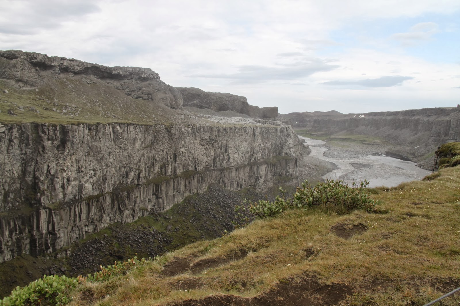
mesitas which would be similar to the barrows in Europe except they are named as 'tables' (mesa). The large stones are set up in a vertical arrangement around a tomb, with three stones (often the side ones are also decorated) forming the front guard area/entranceway. In the museum area there are four mesitas spread over two hills. Other important sites line the hills around San Agustin and a 15km hike will take in the important ones like El Tablon (5 sculptures under a roof), El Purutal (statues with excellent remains of paintwork), La Chaquira (carvings on the rockface overlooking the river) and La Pelota (2 painted statues found in 1984). There are also Los Petroglifos on the right bank of the Rio Magdalena near the Estrecho, and the ambitious can walk to the town of Isnos to see the second park of Alto de los Idolos.
 |
| Lavapatas carved ceremonial fountain |
 |
| This fountain was unearthed in more recent times and has 30 monuments carved into the riverbed including lizards, snakes, salamanders, iguanas, toads, chameleons, and turtles, along with human faces and shapes. |


The painted statues of El Purutal
 |
| La Chaquira - a spectacular location overlooking the Magdalena River |
 |
| Downtown San Agustin village |
San Agustin is not only a great place to visit for its historical records but for the other things that are in the district, from waterfalls to narrow river canyons.
 |
| El Estrecho - the point where the mighty Magdalena River sluices through a narrow 2.5m gap |
 |
| Obando -- underground tombs similar to those found at Tierradentro |
 |
| Salto de Mortino -- 250m high waterfalls just off the road to San Jose de Isnos |
 |
| Salto de Bordones - the highest waterfall in Colombia at 450m |
Source: Cadogan Guides Ecuador, The Galapagos & Colombia 1991 by John Paul Rathbone
Michelin Green Guides Colombia 2011
National Geographic Traveller Colombia 2012 by Christopher P. Baker
Footprint Colombia Handbook 2009 by Charlie Devereux
 A cave is a cave is a cave... well, not really. While I have been to many quite unmemorable caves with nice manicured paths throughout, few have impressed me as much as Slovenia's Postojna cave, mainly because Postojna is just SO enormous at around 27km long.


 To start with, it takes a 2km train to just get into the main cave area. After walking around inside for several hours, one feels as if you have only seen a small part, and the guides tell you that really what you see is only one level, and it actually has three floors, one with a river at the bottom, and we only see one level. Officially, only 20% of the cave is open to the public, and the other 80% includes the river which originally created the caves. The cave really is beautiful as well with various elements represented such as white (calcium), red/orange (iron), black (manganese) and green (plants, moss, our breath). The deepest point of the tour goes to 120m, and is 20m below the cave entrance.
 Smaller caves in the area have been known since the 1200s, but in 1818 and 1819 the bigger caves of the area began to be investigated and the train was established (it was powered by the guide pushing it!). Rumor has it that a drunk man coming home from the pub managed to 'fall' into one of the caverns of the larger cave area and that led to the rest being discovered. One cave with a different entrance close to the top has had visitors for many centuries, with graffiti as proof! In 1841 the 'beautiful caves' of the spaghetti-like stalactites were discovered, but no path existed until WWI, and they were officially opened to the public in 1926. The current path through the caves has not changed since WW2, when prisoners of war carved a tunnel to join two sections of the cave.
  There is no owner of the caves. The land was owned once but now has a 75% concession to a local company with 25% being owned by the Postojna community. It is considered by many to be Slovenia's most important tourist attraction, and the complex includes a butterfly center (ironically called a 'Vivarium' even though they are just specimens pinned to the wall) with various cave species in a small cave complex behind. Here you can see the 'Oms' up close as well as various cave beetles, spiders, flies, and worms. There are many 'no photo' signs inside the cave -- the artificial lights of flashes change the dynamic of the inside of the cave, although to be honest, I didn't really see many people obeying this and where there were lights already set up we were allowed to take photos.
 The noise and light mean that there are actually no 'oms' in the main cave, just in the river galleries below our gallery. They have transparent skin, grow to around 30-40cm in their natural environment, and are around 30,000 years old. I just loved the legends and superstitions that emerged from them: people in the middle ages believed that dragons lived inside the mountains because 'oms' would wash out of the caves after a big storm, and the locals believed these were the dragon babies and this meant that they were very afraid of entering the caves because they thought that there may be big ones to encounter! The biggest om discovered was 44cm.
 Sites inside the caves:


