Showing posts with label nature. Show all posts

Sunday, December 28, 2014

#644 Giant's Causeway, Northern Ireland, UK

It is easy to see what this magnificent natural formation is a UNESCO World Heritage Site. It has inspired and sustained legends and while there are similar formations (like Fingal's Cave on Scottish isle Staffa on the other side of the sea), it is unique. At most 12 meters high and around 28 meters thick in the widest places, they were formed during a volcanic eruption during the Paleogene period 50-60 million years ago as the lava cooled near the limestone forming a similar structure to dried, cracked mud. However, the stones just form part of a 3800 square kilometer area including the surrounding 100m cliffs, which form the largest remaining lava plateau in Europe.

Part of the Antrim peninsula in Northern Ireland, people have been visiting as tourists since the 1693 'discovery' by the Royal Society. It was a popular feature on The Grand Tour as well, popularized by Miss Susana Drury's paintings.
An aerial photo from the http://www.giantscausewayofficialguide.com/ website.

The coastline is dotted with similar coves,all part of the same formation, although not all have the unique columns!
Known as Clochán an Aifir or Clochán na bhFomhórach in Irish, it's name comes from the legend of Fionn mac Cumhaill, who built the causeway when he was challenged to a fight by Scottish giant Benandonner. Benandonner was tricked when he discovered when Fionn's wife Oonagh pretended he was a baby. From the size of the Fionn 
'baby' and speculation as to the size of the father, Benandonner fled to Scotland in fright, destroying the causeway behind him. so that Fionn couldn't follow.

Seen from above.
Unfortunately, a rainy day when wen went!
Stepping stones as perfectly fit together as in a jigsaw puzzle. There are supposed to be around 40,000 interlocking basalt columns, most of six sides (hexagonal), but a few with more or less.
The narrow gap between the causeway and the mainland. Other features at the site include a 'Giant's Boot' and an 'organ' (stacks).
Sources: http://en.wikipedia.org/wiki/Giant's_Causeway
http://whc.unesco.org/en/list/369
http://www.giantscausewayofficialguide.com/

Saturday, November 29, 2014

#645 Milford Sound, New Zealand

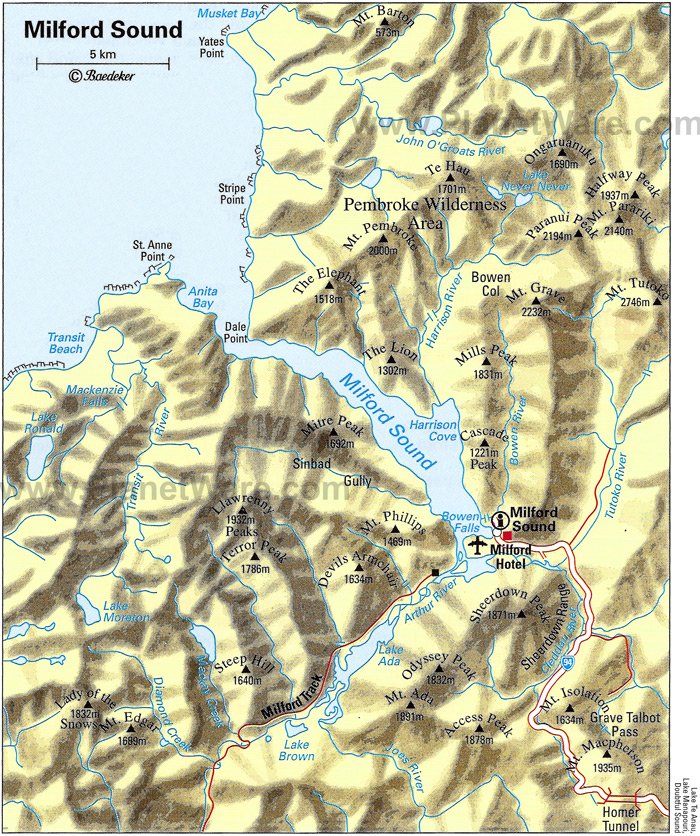
The most famous view of Milford Sound, shown above, is of the steep-sided Mitre Peak (1962m, and actually five closely grouped peaks) sitting imposingly in the middle of the sound. However, this is only one view -- each direction is afforded spectacular views of snow-capped steep mountains, waterfalls, and deep green tanin-filled waterfall-fed ocean. It's impossible to see the open water of the Tasman Sea around the 16km of curves (and other mountains like the Elephant and the Lion), and the flat, calm waters bely its connection to the rough and windy western coast. 
The town of Milford (population 120) lies on a small area of marshy land at the head of the sound where the Cleddau, Tutoko and Arthur Rivers empty into the sea -- there is nowhere else the town really could be and it is one of the few sounds that has land suitable for a settlement. It includes an airstrip from which frequent scenic flights depart, a cruise terminal and jetty, and an old THC Hotel, but not really much else. Similar to Doubtful Sound (#729), its less famous neighbor, and the other 12 sounds, it is part of the Fjordland National Park and Te Waipounamu, the UNESCO World Heritage Site. However, it is the only sound in the park with road access for tourists. 
www.planetware.com
For years, Milford Sound was only accessible by sea or by foot, until the famous 1.2km Homer Tunnel was opened in 1954 (it was begun in 1935) under the Darran mountain range. Milford is still very inaccessible, with the one road going in that's often snowed under in winter. It's 2 hours (121km) to the nearest town, Te Anau.
The wettest place in New Zealand, snow remains even in summer.
While the Maori have used the MacKinnon Pass (found in 1888 and made part of the Milford Track) to access the sounds to collect pounamu (greenstone) for around 1000 years, and called it Piopiotahi after the place of mourning of the "first" now extinct Piopio bird and the legend of Maui's death trying to win immortality for mankind, it wasn't until John Grono landed in 1812 that it was named Milford Sound after Milford Haven in Wales. Rudyard Kipling apparently called it the 8th wonder of the world!
The Eglinton Flats, along with the Te Anau Downs are the beginning of a road journey into Milford.
The Gleddau River
The landscape right outside the Homer Tunnel - Keas love it here!
The Chasm is halfway between Milford and the Homer Tunnel and gives an idea of the quantity of rainfall and the force of the water carving the valleys (although the sound itself was formed by a glacier during the last ice age.
The river marshes around Milford afford excellent bird watching!
Waiting in line for the single-lane Homer Tunnel on the
Milford Side, while keas pester tourists and land on cars. 
http://www.milford-sound.co.nz/
https://en.wikipedia.org/wiki/Milford_Sound
https://en.wikipedia.org/wiki/Homer_Tunnel

Tuesday, August 19, 2014

#653 Zion National Park, Utah, USA

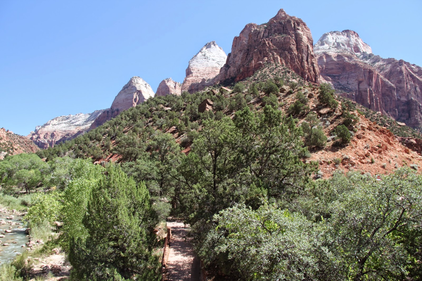
View of Zion National Park just before and after the gates.
Before I went to Zion National Park, a friend told me to try and accomplish two things: the Narrows and Angel's Landing. These are truly amazing, but only a tiny part of this small and spectacular National Park. The north fork of the Virgin River carves the beautiful Navajo sandstone into Zion Canyon, a 24km long and 800m deep. Going from 2600m down to 1100m in elevation, the landscape changes from a cool mountain climate to the red deserts leading off into Nevada, representing one of the steepest stream gradients in the US. It incorporates the three diverse geographic areas of the Colorado Plateaus, the Great Basin and the Mojave Desert.

Walking up 'the Narrows' involves going as far into the park and up Zion Canyon as possible, and hiking to the end of the trail, known as the Temple of Sinawava (the Coyote God of the Paiute tribe), then continuing the trail in the river as it winds through a narrow canyon which gets smaller and smaller. 
Small slots of side streams cut through the spectacular rock and eventually the river splits, about 2 hours walking up river. Around 2000m high and as wide as 20m in some places, the canyon narrows to a 1m squeeze in the side streams, so as you can imagine flash flooding is a serious risk.
It's a popular hiking spot, and by midday there are many people going both into and coming out of the canyon. The slippery rocks make it hard to walk but the water and canyon are cooler than the heat of the main canyon.
The area was settled by small family groups of Basketmaker Anasazi, the Parowan Fremont and other Native Americans from around 8000 years ago. Later they were joined by the Paiute and Ute. Spanish padres Silvestre Velez de Escalante and Francisco Atanasio Dominguez passed close by in 1776, and Jedidiah Smith explored some of the area for the American Fur Company. Mormons arrived and settled in the 1850s. 
Big Bend near the top of the park
Originally, it was going to be called the Mukuntuweap National Monument when it was established in 1909, but the acting director felt that an unpronouncable (Indian or Spanish) name would deter visitors from coming. The northern section of the park, called Kolob, which has a separate entrance, was originally a separate monument, but they became one park in 1956.

Walking up to Angel's Landing is not easy, but has one of the most spectacular views in the park -- all the way down the valley, and it also has one of the most exciting trails. The end is a scramble up rocks with sheer cliffs on either side and only a small metal wire to hold onto, but before that there are Walter's Wiggles which weave the trail up the inside of a narrow canyon half way up the mountain (he was the visionary who created the trail back in the 1920s).

The main part of the park is only accessible by the shuttle bus in peak season (in winter, cars can drive all the way in), but the main Zion-Mount Carmel Utah highway (Route 9) also goes through the park, with amazing views and an awesome tunnel (finished in 1930) cut into the side of the cliff with little view holes spread throughout.


View from the Zion-Mount Carmel Tunnel entrance
Biggest natural arch in the park
The canyon overlook trail is a short walk from the top of the tunnel.
Checkerboard Mesa
Other trails that I didn't have time to do included the Weeping Rock, Taylor Creek, Kolob Arch, the Subway, the Emerald Pools, Mineral Gulch, Pine Creek Waterfall, the West Rim Trail, Wildcat Trail and many more! I guess I'll just have to go back!


Source: http://www.nps.gov/zion/index.htm
http://en.wikipedia.org/wiki/Zion_National_Park
http://www.utah.com/nationalparks/zion.htm
http://www.zionnationalpark.com/
http://en.wikipedia.org/wiki/Zion_%E2%80%93_Mount_Carmel_Highway