Showing posts with label Iceland. Show all posts

Thursday, April 24, 2014

#685 Seljalandsfoss, Iceland


When I was a child we used to joke that Greenland was icy while Iceland was green, and I think when I went to visit Seljalandsfoss that green epitomy was at its height. It was a rainy, misty, miserably wet day, and it was my first day driving around Iceland -- I wondered what I'd gotten myself into because it wasn't really that much fun to drive in, even if it was beautiful (what little you could see).

Seljalandsfoss comes up out of the mist after driving along a flat boring plain for hours. It is a 60m high falls tumbling off a cliff rising from the flats, and you can see it from the ring road, along with the other cars and buses at the parking lot right below it. I stopped because it was the first waterfall I'd seen that day (I would go on to see around 15 more), not really realizing how magical it was. It's one of the most famous waterfalls in all of Iceland and adorns many postcards and calendars. A really great sunny day photo of the waterfall can be found here. The waterfall is located between Selfoss and Skogafoss just off the Route 1 Ring Road on the track going to Thorsmork.

When I was a child I watched Robin Hood bathing in a waterfall (I think that was the gossiped about naked Kevin Costner scene!) and thought how cool it was that there were waterfalls that you could go behind. I finally got to experience that magic at Seljalandsfoss. It was the fairy tale, dream-like secret path that could lead to hidden caves and mysteries... except it was just a path... although it was magical.

Wet-weather clothes were something I'd bought at the last minute before leaving for Iceland, not really having packed wisely when I'd left home several weeks before. Into dry pants and jacket I scrambled for the rain, but I would have needed them for the waterfall anyway. Going behind a waterfall is wet business!
Here are some videos where I tried to catch the magic (or at least try and catch the wet before it splashed and fogged up the camera!).


Wednesday, February 12, 2014

#714 Seydisfjordur, Iceland

Although most visitors to Iceland arrive by air into Reykjavik, some lucky travelers ferry in from the Faroe Islands/Denmark and arrive in the idyllic bohemian hamlet of Seydisfjordur, on Iceland's eastern coast. I have to say it was one of my favorite places in Iceland, though as I was very lucky with the weather there, I'm sure that helped!
With pretty multicolored wood houses (built by Norwegian merchants), only two restaurants and one supermarket, and a handful of hotels, one would never call it bustling, but its spectacular location can't be beaten. The sheer snow-capped mountains surround it on all sides, with beautiful waterfalls cascading down creating lovely gushing water music, but also causing a large avalanche threat (an 1885 tragedy killed 24 people and in 1996 a factory was flattened). The steep mountain pass leads the only way out of the valley, snow-laden even in mid-summer, and the only way to get to Egilsstadir and the rest of Iceland.
 
The fjord is 17km long and a rough dirt track winds its way to the end. The main settlement began in 1848 as a trading center and it found a boom product in herring. During the second world war it was a British and American base (an oil tanker suffered a close German bomb sinking to the bottom of the fjord), but now bases its economy on fishing, the ferry and a growing artist/musician/crafts community.
Seydisfjordur is a technology leader as well as being the connection with the rest of the world, offering the location for the first submarine telephone cable to Europe (1906), the first high-voltage hydro electric power station (1913). Skiing, kayaking, bird-watching, hiking and even Settlement Era archaeology (at Skalanes on the mouth of the fjord) are just some of the possible pursuits available.

Source: Lonely Planet Iceland 7th Edition, 2010

Monday, October 14, 2013

#766 Dettifoss, Iceland

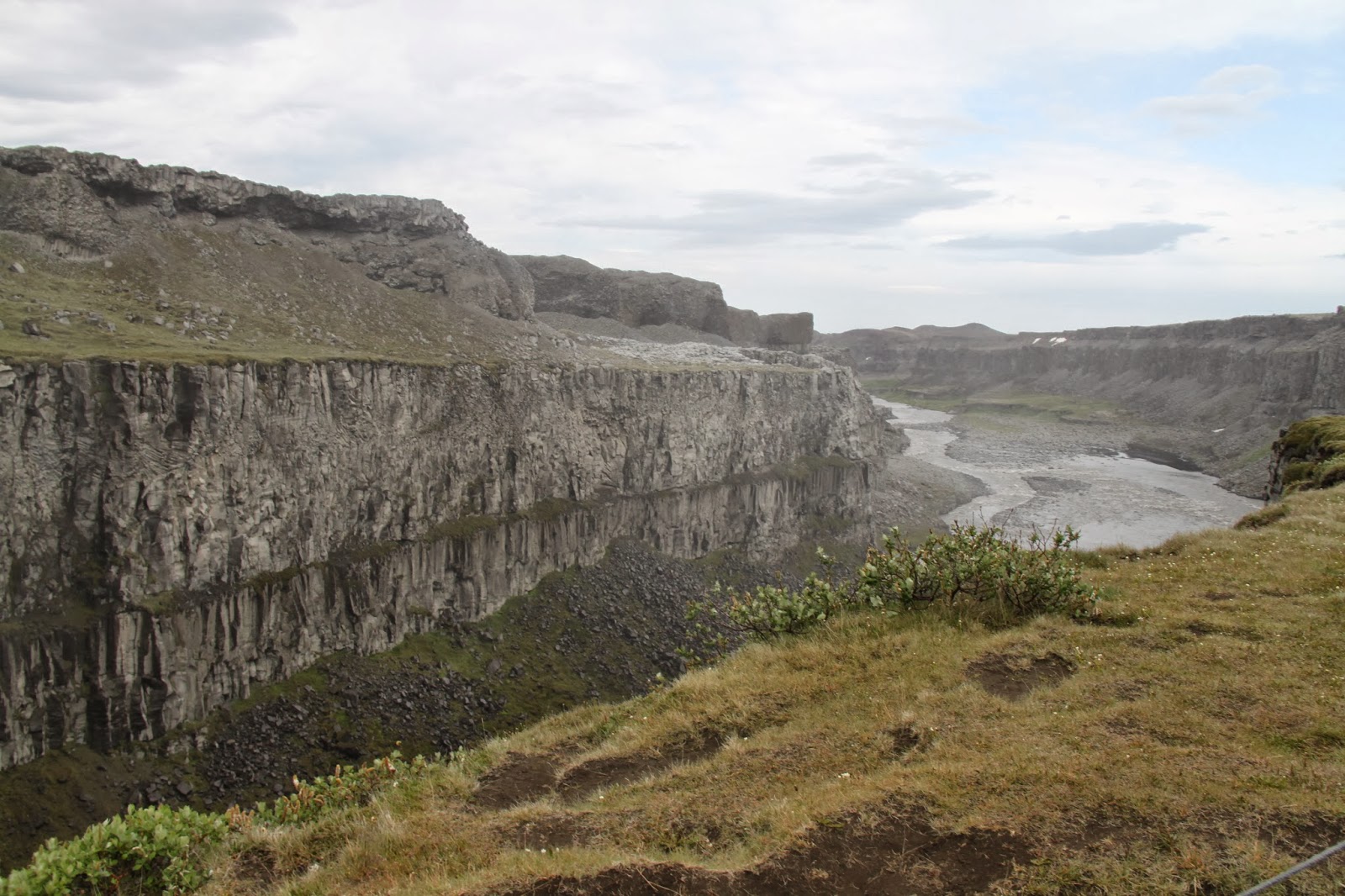
One of Iceland's mightiest waterfalls lies just northeast of the Lake Myvatn in  Vatnajökull National Park. It is not so high (at 44m) or so wide (100m) but the volume of water that passes over the water creates a mist visible a kilometer distant down the valley. 193 cubic meters pass over the edge every second which makes it the highest volume waterfall in Europe. You can see the falls from either side of the canyon, although the western bank has a broader perspective (these photos are taken from the eastern bank).
Other beautiful waterfalls lie up and down the Jökulsá á Fjöllum River at Selfoss (1.5km) and Hafragilsfoss (2km) from Dettifoss.
Source: Lonely Planet Iceland, 7th Edition, 2010
http://en.wikipedia.org/wiki/Dettifoss

Wednesday, August 7, 2013

#795 Geysir, Iceland

In the middle of apparent farmland in Iceland lies an amazing geological formation and the root of our English word, geyser. Before Old Faithful in Yellowstone, or the geysers near Rotorua in New Zealand was Geysir, the first really famous spouting water.
Strokkur erupting
From the Icelandic (Old Nordic) word 'to gush' Geysir was the first written record of a spouting hot spring known to Europeans. The park lies in the Haukadalur valley at the foot of the Laugarfjall hill, and houses not just one, but around 30 separate glaciers. Geysir is the biggest, shooting water up to 70m into the air and even higher in extreme cases, but in recent years has become less frequent and reliable. Strokkur geyser is far more reliable, erupting approximately every 15 minutes but to a lesser, but still impressive 20m-30m in height. Many photographs of Strokkur are mislabeled as Geysir!

Connected to earthquake and other geothermal activity (Iceland lies right in the middle of the Great Atlantic Rift between the North American and European tectonic places) the geysers have been active for around 10,000 years, but have changed locations frequently due to the moving tectonics. Man-made interference has also altered the activity, both by cutting a channel into the silica edge, but also later they were simulated by adding soap (this practice stopped in the 1990s due to environmental concerns).
An interesting fact - it was once owned by Brit James Craig (Lord Craigavon and later Prime Minister of Northern Ireland), who gave it to a friend, who sold it to an Icelandic film director who gave it to the people of Iceland for perpetuity (thank goodness!).
File:Geysir3.jpg
http://en.wikipedia.org/wiki/File:Geysir3.jpg Taken in 2012
A short video of Strokkur erupting in July 2013:
Source: http://en.wikipedia.org/wiki/Geysir

Friday, July 12, 2013

#806 Thingvellir, Iceland


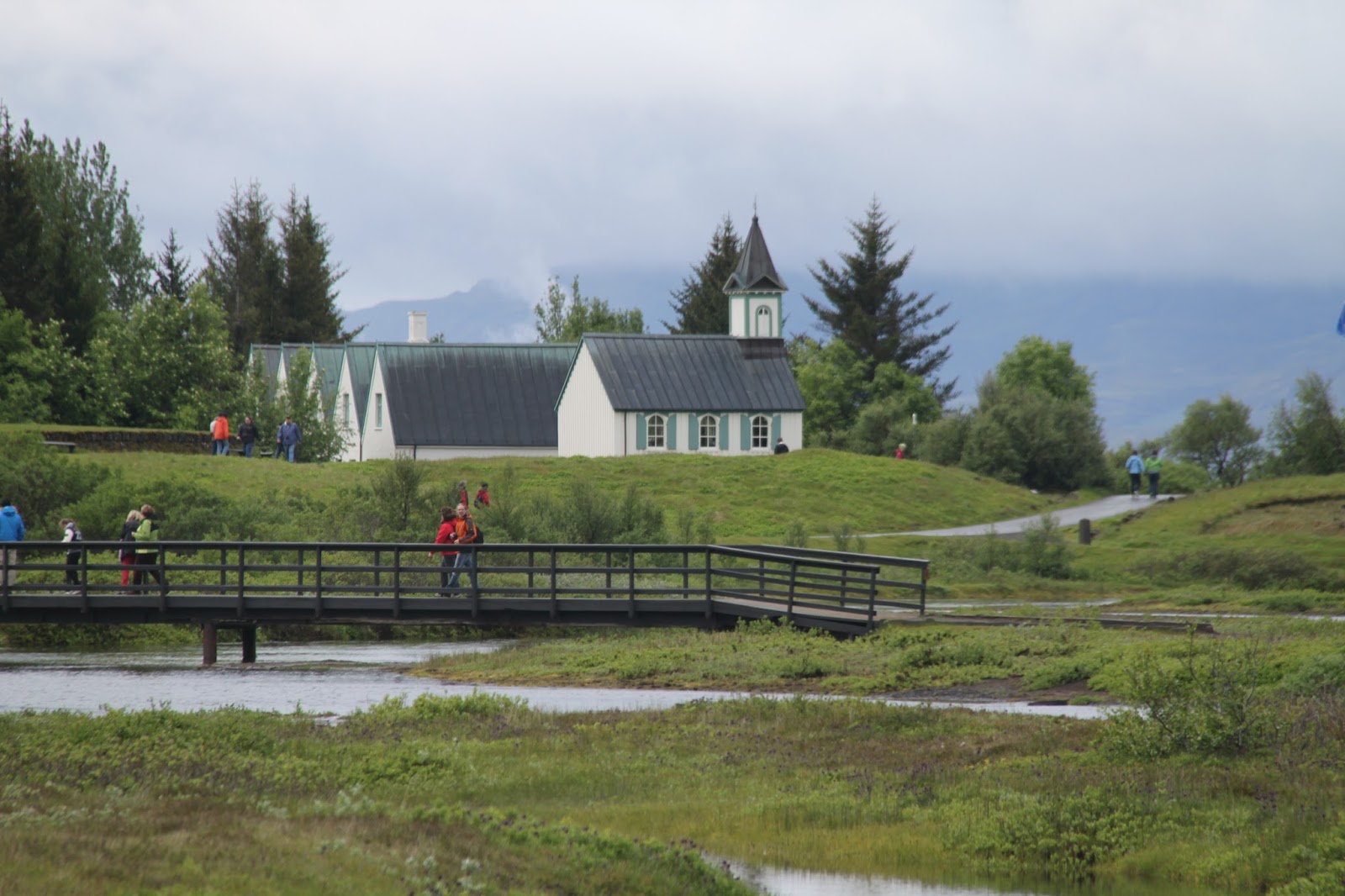
Iceland's most important historical site is 23km east of Reykjavik, but it feels like it is in the middle of the wilderness. The location of the first parliament in the world is a grassy knoll in the middle of a national park renowned for nature walks and green-grassed lake banks. Part of the Golden Circle of tourist attractions with Geysir and Gullfoss, it has been visited by all travelers to Iceland for hundreds of years.
In 930 AD the Vikings established the first democratic parliament of rule (the Althing) here because they were pleased to be separate from their kings at home and thus developed 'things' (assemblies). These eventually worked themselves into a national assembly. One brother learned the laws and passed them on verbally from generation to generation, and another brother found the site Blaskogur (Parliament Fields). As with many of the sites from the sagas, there is not much left aside from the law rock (Logberg), and the fact that despite the marvelous achievement of democratic self-rule, Icelanders later relinquished power back to the royals of Norway and Denmark (in 1271), so while it may have been the first, it was not a continuous course. It functioned as a courthouse until 1798 when it was dissolved completely, only to be reinstated in 1843 but relocated to Reykjavik. One of the most important decisions made here, however, was the conscious choice to make Christianity the country's religion (as opposed to Pagan beliefs -- if only modern religion could be decided so democratically!).
I think one of the more poetic things about the site is its geological location. Sitting right on the top of the great Atlantic Rift of the two continents' (North American and Eurasian) plates drifting visibly apart (18mm per year). Mossy lava flows, wrinkled rocks, deep fissures (such as Flosagja and Nikulasargja named for a freed slave and a dead drunk sheriff), the Almannagja cliffs, and spectacularly clear icy lakes and pools make it even more beautiful (although those lovely lakes were used to drown women found guilty of infanticide or adultery!). The site was chosen for its lakes full of fish (such as the enormous Thingvallavatn, Iceland's biggest lake at 84 sq km), the Oxara River (which was actually diverted to maximize its flow and convenience), the proximity of firewood as well as the dramatic setting to give aura to the orators. It was a great summer gathering with traders, entertainment, marriage contracts occuring, and other communal gatherings. Evidence of various family/regional booths can still be found at the foot of the cliffs, and the farmhouse built in 1930 (for the 1000th anniversary) is the park headquarters and president's summer house. 
Photo on a tourist notice board at the site with the rifts visible in the landscape.
Sources: Lonely Planet Iceland 7th Edition