Showing posts with label islands. Show all posts

Tuesday, December 30, 2014

#643 Saint George's, Bermuda

St. George's Town was first settled in 1612, the first permanent British settlement on the islands of Bermuda and its capital until 1815. Some claim it is the oldest continually inhabited English city in the New World. Originally called New London, it was a stopping place for the ships of the Virginia company on their way to Jamestown and other settlements.
Ordnance Island is connected to St. George's by a short causeway, and much of the waterfront is reclaimed land.
With quaint names and narrow alleys, the town is fun to visit, and prettily decorated in a traditional style, with the typical Bermudian water-collecting roofs on display.

The main town square, King's Square, is bounded by the 1782 Town Hall to the east, the Bermuda National Trust Museum to the north-west, and Ordnance Island.
The location of hangings, Ordnance Islands guns signify its past, but is now used as a cruise ship terminal.
A replica of the Deliverance, one of two boats built by survivors of the 1609 shipwreck Sea Venture that was stranded (deliberately sent onto the reef) on Bermuda on their way to Jamestown, VA, and led to the first settlers of the islands.
Other historic landmark sites to see in the town include the first stone building, the 1620 State House, the Old Rectory, St, Peter's Church, the Tucker House, and the Mitchell House (housing the St. George's Historical Society Museum, and the Featherbed Alley Printshop Museum), along with the oldest structure on the island, the L-shaped Bridge House. Along with its fortifications, it was designated a UNESCO World Heritage Site in 2000.
The unfinished church is above and behind the town on a hill. Construction began in 1874 after the town's main church, St. Peter's was damaged in a storm. The local populace was divided, however as to whether to repair the old church or construct a new one, so it was never finished. In 1926 a bad storm significantly damaged what was there. It is closed to the public for safety reasons, but you can peek through a window like me!
Source: http://www.bermuda-attractions.com/bermuda2_000027.htm
http://en.wikipedia.org/wiki/St._George's,_Bermuda
http://www.bermuda-attractions.com/bermuda2_000028.htm
http://whc.unesco.org/en/list/983

Saturday, September 20, 2014

#650 Grace Bay, Turks and Caicos Islands

The 11 or so kilometers of soft white sand that make up Grace Bay's beach are reported to be one of the best beaches in the Caribbean - in fact in 2011 and 2012, TripAdvisor users voted it the best beach destination in the world. If one was counting large resorts (30+), the presence of such a variety of places to stay would certainly convince you: from the Seven Stars, to Grace Bay Club, Club Med, the Somerset, the Venetian, Windsong, the Alexandria, the Sands or the all-inclusive Beaches, this is the destination for the island of Providenciales, plus there are also many smaller resorts and private residences.
Trying to capture its loveliness is difficult as every image seems similar - it's just so perfect. What is it that makes it great? The reef prevents any large waves so it is calm and safe -- surf lovers can look elsewhere on the island. The waters are a perfect, beautiful turquoise and blue, apparently from the purity of the white sand (which is so fine it acts like a glue on your feet!). There is world-class diving on the wall of the surrounding reef -- it is part of the third-largest barrier reef system in the world. Perhaps its so great because it seems no one has heard of it?
It got its start when Club Med built an exclusive hotel in 1984, and as it was a deserted beach until then, it was idyllic (only nearby Turtle Cove had begun to be developed). 
Note: The Turks and Caicos Islands are part of the British West Indies, a territory of Britain.
http://news.travel.aol.com/2011/04/05/tripadvisor-names-top-beach-destinations/
http://www.gracebay.com/
http://www.traveller.com.au/secrets-out-where-to-find-the-worlds-best-beach-1z9f4
http://www.visittci.com/providenciales/about

Saturday, August 30, 2014

#652 Royal Naval Dockyard, Bermuda

The most visited tourist site in Bermuda, mainly because it is the entry point for most tourists to Bermuda (i.e. the docks for cruise ships) are the Royal Navy Dockyards. Savvy enough to embrace these visitors, the dockyards maintains a Facebook page, a webcam, a youtube video (see below), as well as several websites introducing tourists to the shops, artists workshops, activities, restaurants and other options.

Ruins of barracks
The fort (HMD Bermuda) was controlled by Britain until 1995 (although they had limited operations from 1951 when the area was known as HMS Malabar), and constituted its main Atlantic base from the time of American Independence through to the Cold War. Slaves and convicts constructed the large complex, and around 2000 died in the process. It was used as a base for ships attacking Washington, DC during the War of 1812, and was a crucial base during the World Wars


The Keep, at the far end of the area, is now the National Museum of Bermuda, and the big building on top of the hill, the restored Commissioner's House, dominates the area.


The dockyards are no longer used by the Royal Navy, but they continue to be used in boat construction and repair, while the rest of the area is dedicated to tourism. 

The Queen's Exhibition Hall used to be the storage area for gunpowder and weaponry, and the heavy crates have left clear lines on the floors!
Dolphin Quest is an area you can swim with dolphins (for upwards of $500 or so).
I am not happy about these dolphins being held captive here.
Casemates Barracks with the fortified wall behind, which separates the dockyards area from the rest of Bermuda.
6 foot guns are rusting away along the parapets. 
Graham Foster's very impressive Hall of History Mural which includes all small images showing all of Burmuda's centuries old history is inside the Commissioner's House.
I wondered why the Commissioner's House wasn't more of an obvious target. It rises high above the rest of the Fort area and the views, while spectacular, can only mean that they must have been attacked and aimed for! 

View from the Commissioner's House looking back towards the dockyards, the (empty) cruise wharves (Heritage Wharf and King's Wharf). The barracks at the far end were connected to the keep by a high wall. In front is the Queen's Exhibition Building (armory).
Clocktower Mall - the old storehouse.
Check out Bermuda Tourism's youtube video of Dockyard: 
http://www.bermuda4u.com/maps/royal-naval-dockyard/

Thursday, March 13, 2014

#703 Jeju Do, South Korea

Tolharubang

It's often reported that the most highly trafficked plane route in the world is the route from Seoul (#970) to Jeju Island in Korea, although I really couldn't say where I heard it and if that statistic is really up to date. This island, 85km south of the peninsula in the South Sea (East China Sea), is a honeymoon, holiday paradise. It has been compared to Hawaii, the Mediterranean, and Disneyland for valid reasons. 

With a beautiful sub-tropical volcanic landscape, a unique culture that evolved separately from the mainland due to few visitors, and the ocean beyond, it is not surprising that it is the place Koreans tell you to visit. Jeju City is the location of the main airport on the northern coast of the island. Similar to many other Korean cities, it holds the Samseonghyeol Shrine (with harubang) as well as a nice seafront and history museum.  
The isolation allowed Jeju to form a unique architectural style: stone houses with thatched roofs tied down in the strong winds. It was for a time during the Joseon dynasty, a haven for exiles: intellectuals, Catholic converts and political undesirables.
Harubang statues (see right) are as connected to Jehu as Easter Island's are to them. Translated as 'grandfather', the first ones was carved in 1750 and left outside fortresses (45 of these still exist). Purpose unknown, they are distinct in their helmet heads, bulgy eyes and noses, and their asymmetrical hands on stomachs.
Jeju Folk Village
Manjanggul Grotto - the world's longest lava tube
Site 1: Manjanggul Lava Tube Caves
The world's longest system of lava tube caves is east of Jeju-si: 13.4km long, 2-30m high, 2-23m wide, 10 degrees inside, these huge black tunnels are an impressive view of ancient geological forces.
Pony - the special Jeju breed
Sunrise Peak at Songsan
Site 2: Seongsan Ilchulbong Crater
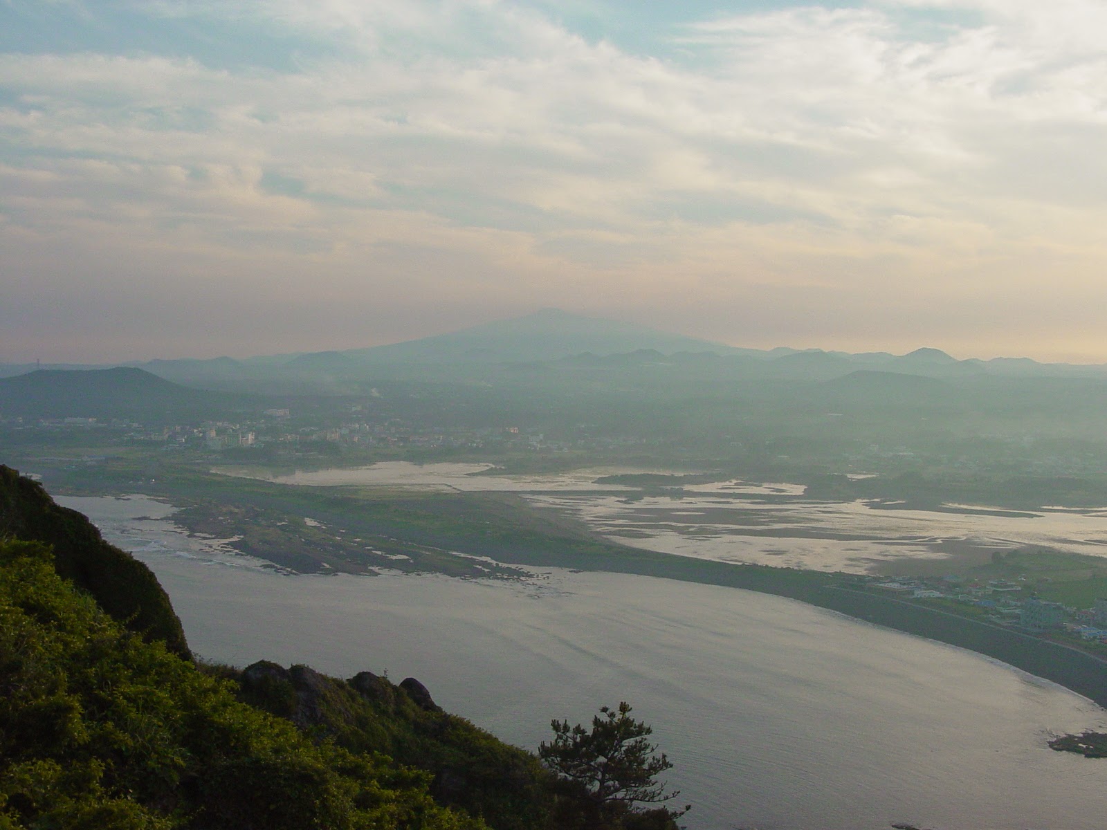
At the island's eastern point is the extinct volcanic plug, Ilchulbong, with Seongsan-ri Fortress at its base. 182m at the summit, the inside of the crater has been left to wild grass. The ground is so porous that any crater lake has drained away despite its punch-bowl shape. 20 minutes walk to the summit affords spectacular views back towards Jeju-do.

Port Seogwiko
Site 3: The Southern Coast
Seogwipo, Jeju's second biggest city, lies on a pretty harbor in the southern coast's subtropical zone of inlets and cliffs. A touristy town with several charming waterfalls nearby, there is good diving off the coast, as well as ballooning and the World Cup Stadium 6km west of town.
Cheonjeyeon Pokpo is a three-tier waterfall in a pretty gully near Seogwipo. The Seven Nymphs footbridge above, named for the seven carved beauties who served the Emperor of Heaven and supposedly slid down the moonbeams to bathe here every night.
Seven Nymphs Bridge
Chonjeyon Waterfall
Chonjeyon Waterfall
Jusangjeolli Rocks just south of the Convention Centre, are a 2km stretch of spectacular hexagonal-shaped-rock-strewn coastline. Made during the rapid cooling and contraction of lava when it hits the ocean, there are also waterfalls streaming off (such as the Chongbang falls pictured below) to increase its spectacle.
Chongbang Waterfall
Chongbang Waterfall
Rugged Rock of Chungmun
Harubang at the World Cup Stadium


Yongduam (Dragon Head Rock)
Woidolgoi Rock
Paengoktam Crater of Hallisan
Site 4: Hallasan
The central mountain, Hallasan (Mt. Halla) is South Korea's highest, and its national park has a unique range of flora and fauna in its four separate ecological zones that change with the seasons. It tends to collect clouds easily, so I didn't actually see it!
Paengoktam Crater of Hallisan
Five hundred disciples of Buddha. Yongsill rugged rock.
Flora of Mt. Halla seen from Songpanak
Other places on Jeju-do that I didn't make it to:
Moksogwan - just south of Jeju City, it has wood and stone installations
Fortress site of Nammun Gate in Songup Folk Village
Song-up Folk Village
Hallim Park entrance to Hyopchaegul Cave
Underground Pillar in Hallim Parrk
Spiritual Sanbangsan
- a sheer-sided rock on the southern coast
with a grotto temple and healing water
Source: Please note that the photos with the borders are taken from postcards.
Lonely Planet Korea 7th Edition 2007