Sunday, November 9, 2014

#646 Big Sur, California, USA

Number one on roads to see before you die, I can agree that it is a spectacular drive! This "most adored" of California's highways, took 18 years to build (as part of the Depression Era's New Deal), and most of its residents didn't get electricity until the 1950s. The Spanish bypassed it for being too rugged (they called it "el pais grande del sur" or the big country of the south, and until the road was built in the 1930s, it was one of the most remote parts of California. Aside for the famed 85km stretch of winding Highway 1 - which is NOT a freeway so take time -- there's a castle, sea lions, birds, redwood forests and many beautiful beaches and trails to see and walk.
From the Monterey Peninsula and Carmel in the north to San Simeon in San Luis Obispo County in the south, the road follows the Santa Lucia Mountains as they rise sharply from the sea (Big Sur's Cone Peak is the largest coastal mountain in the contiguous United States at 1571m).
Hearst Castle
The history of the area starts with the Native American Ohlone, Esselen and Salinan tribes, who left few artifacts aside from obsidian and flint arrowheads. The Spaniards sailed past in 1542, but chose to settle further inland where several Catholic Missions can be found. It was part of Mexico after their independence from Spain in 1821, but was ceded to the United States after the Mexican-American War in 1848. The 1862 Homestead Act brought hardy settlers who were granted plots of 160 acres, and many of the region's names date from this era and these families. The Gold Rush era saw the cutting down of many redwoods and the establishment of various landings and camps (as there were no reliable roads), but most of these have disappeared today. In 1894 the SS Los Angeles ran aground near Point Sur light station, but its inaccessibility encouraged politicians to propose a road.
The road was approved in 1919 and construction began with convict labor from San Quentin Prison. The route included 33 bridges (Bixby Bridge is the largest) which became part of the National Register of Historic Places in 1986. Originally Route 56 when it was finished in 1937, it was re-designated Highway 1 in 1939.It was the first State Scenic Highway (in 1965) and also holds the title of All American Road. 
Relative isolation in the mid 20th Century brought artists and hippies, from Jack Kerouac to Henry Miller and Hunter S Thompson. Elizabeth Taylor and Richard Burton also filmed The Sandpiper in the area, and bands from the Beach Boys to the Red Hot Chilli Peppers have eulogized the area in songs.
Los Padres National Forest is a unique ecosystem in the middle of the otherwise quite barren area.

The road is sometimes closed due to landslides and the seasonal California fog is a frequent visitor.

The most famous view of Big Sur is this view of Bixby Bridge, built in 1932.

#647 Arab Fund Building, Kuwait

The Arab Fund for Economic and Social Development (AFESD) is a Kuwait-based finance group established by the Arab League in 1972. Their headquarters are in Kuwait City, and although they aren't a traditional tourist site, by appointment, you can request a tour of the magnificent facilities. 
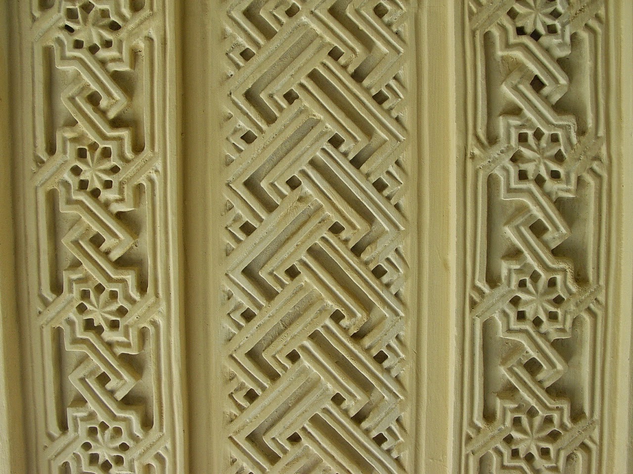
Built along Arab design principles and incorporating specific decorative elements from across the Arab world, it is peaceful, airy and beautiful. It includes a large central atrium (8 floors high!) with wooden latticed windows leading into meeting rooms and other quiet alcoves. Craftsmanship from many countries was incorporated in the beautiful tile zellij, lush carpets, delicate stained class compositions, and fine wood carving. Enormous intricate chandeliers are hung in all areas and the brass doorknobs impress!


Sources: http://www.lonelyplanet.com/kuwait/kuwait-city/sights/architecture/arab-fund-building
http://en.wikipedia.org/wiki/Arab_Fund_for_Economic_and_Social_Development
http://www.arabfund.org/

Saturday, October 25, 2014

#648 Sans Souci, Ramiers, and Citadelle, Milot, Haiti

The history lesson for today's post is about Haiti. You may already know that Haiti had one of the first successful slave rebellions under Toussant Louverture which led to independence for Haiti from France by 1800, but what you may not know is that after their first president Dessalines, the country split in two, and the north, called alternatively, the Kingdom of Haiti or the State of Haiti (the south was the Republic of Haiti), was ruled by the self-titled Roi (King) Henri Christophe. Despite his system of forced labor, unpopularity at the time and his eventual suicide in 1820, he is adored throughout Haiti today for the impressive monuments that he left behind: his enormous palace and system of buildings Sans Souci, the formidable Citadelle high atop 910m Pic La Ferriere (Bonnet a L'Eveque Mountain), and the system of fortresses to support it on the southern side, the Ramiers. Each could easily have been a post of its own, but because they all owe their existence to his drive and ingenuity, they are together in one post. In a symbol of Haitians' inferiority complex, they marvel that one of them was able to create such a feat of engineering and power and are incredibly proud of it, and indeed, it is a very impressive set of complexes.
Sans Souci Palace  or "Carefree Palace"
The palace, built between 1810 and 1813 where Christophe (who was actually from Grenada, not Haiti) installed his wife Marie-Louise and family, was constructed at the same time as the citadelle, although completed before Christophe's death unlike the citadelle which had elements still to be constructed and further plans in the works. 
This view shows the hospital, school, swimming pool and fountain. The complex was more than just a place to live but an entire administrative complex spread over 8 hectares, where Christophe hosted opulent feasts and dances. It also included a printing shop, garment factory, distillery, medical faculty, chapel and military barracks. In one of the second floor rooms in the middle of the palace, Roi Henry Christophe shot himself with a silver bullet in 1820. The palace was ransacked and the majority of the family moved to Italy, where there had already been a strong connection if the marble statue above is to be believed. They continued to be an influential family in Haiti, and his grandson Pierre Nord Alexis became president of Haiti from 1902-1908 and his great-great-great-great-grandaughter Michele Bennett was first lady of 'Baby Doc', Jean-Claude Duvalier.
The Citadelle
The original aqueduct to remove excess
water from the fortress. It was damaged
and many parts of the roof covering
collapsed in the 1842 earthquake.
Able to be seen from all sides around from many kilometers away (such as Cap-Haitien 17km north, or even Cuba on a clear day), the citadelle is an impressive structure, but walking up to it along a steep cobbled path (2 and a half km in the hot sun!) it becomes even more spectacular. It is situated above the village of Milot, and it offers 360 degree panoramas of any invading armies, so aside from being built to show the abilities of blacks, Dessalines ordered his general, Christophe, build it because he feared a French reinvasion, which had happened in 1802 when Touisant was sent to France to die in prison, though it was short-lived. This is also why Christophe's palace was so far inland, in order to be well away from the strong British and French naval boats. 20,000 workers slogged for 15 years (from 1805) to built it, with unknown lost lives, and even then it wasn't finished.
Aside from being the biggest fortress in the Americas, the citadelle holds the worlds best collection of 19th century armory, and none of it was ever used in war as no land invasion ever occurred. There are cannon gifts from England and Spain with decorative motifs and emblems, not to mention fish shaped handles. This was in spite of the mockery many felt towards the creation of the kingdom and various nobility and peerage within it.

Other amazing facts:

  • the walls rise 130 feet (40m) from the mountain top
  • the whole complex covers 108,000 square feet (10,000 square meters)
  • the structure uses no cement, but a mortar mixture of quicklime, molasses,  cow hooves, and the blood of cows and goats
  • cisterns and storehouses could store enough food and water for 5000 defenders for upt to a year
  • the fortress had palace quarters for the king and his family if needed
  • other features included dungeons, jails, bathing quarters, and a bakery
  • the citadel appears like the prow of a ship jutting out from the mountainside.

The king's brother's tomb is in the fortress, after he died in a gunpowder accident in 1818 and the king's body is also somewhere in the inner courtyards of the citadelle after his loyal followers covered his body in quicklime and secretly buried the body after his suicide.

Ramiers
Although quite hard to discern in the image above, there are a series of 4 fortresses and the Queen's palace that line the hillside to the south of the Citadelle. Above the town of Dondon (which apparently was the Taino capital before the Europeans arrived, due to the 25+ caves they could live in), they are flattened pyramids with drawbridges and served as protection from a land-based army coming from the south. 

Note - Christophe built up to 9 palaces, 15 chateaux, forts, summer homes (on the 20 plantations he owned), so these three complexes are only a small part of his megalomania!

Sources: Footprint Caribbean Islands, 15th Edition , 2004
http://whc.unesco.org/en/list/180
http://en.wikipedia.org/wiki/Henri_Christophe
http://en.wikipedia.org/wiki/Kingdom_of_Haiti
http://en.wikipedia.org/wiki/Sans-Souci_Palace
http://en.wikipedia.org/wiki/Citadelle_Laferri%C3%A8re