The most famous view of Milford Sound, shown above, is of the steep-sided Mitre Peak (1962m, and actually five closely grouped peaks) sitting imposingly in the middle of the sound. However, this is only one view -- each direction is afforded spectacular views of snow-capped steep mountains, waterfalls, and deep green tanin-filled waterfall-fed ocean. It's impossible to see the open water of the Tasman Sea around the 16km of curves (and other mountains like the Elephant and the Lion), and the flat, calm waters bely its connection to the rough and windy western coast.
The town of Milford (population 120) lies on a small area of marshy land at the head of the sound where the Cleddau, Tutoko and Arthur Rivers empty into the sea -- there is nowhere else the town really could be and it is one of the few sounds that has land suitable for a settlement. It includes an airstrip from which frequent scenic flights depart, a cruise terminal and jetty, and an old THC Hotel, but not really much else. Similar to Doubtful Sound (#729), its less famous neighbor, and the other 12 sounds, it is part of the Fjordland National Park and Te Waipounamu, the UNESCO World Heritage Site. However, it is the only sound in the park with road access for tourists.
www.planetware.com
For years, Milford Sound was only accessible by sea or by foot, until the famous 1.2km Homer Tunnel was opened in 1954 (it was begun in 1935) under the Darran mountain range. Milford is still very inaccessible, with the one road going in that's often snowed under in winter. It's 2 hours (121km) to the nearest town, Te Anau.
The wettest place in New Zealand, snow remains even in summer.
While the Maori have used the MacKinnon Pass (found in 1888 and made part of the Milford Track) to access the sounds to collect pounamu (greenstone) for around 1000 years, and called it Piopiotahi after the place of mourning of the "first" now extinct Piopio bird and the legend of Maui's death trying to win immortality for mankind, it wasn't until John Grono landed in 1812 that it was named Milford Sound after Milford Haven in Wales. Rudyard Kipling apparently called it the 8th wonder of the world!
The Eglinton Flats, along with the Te Anau Downs are the beginning of a road journey into Milford.
The Gleddau River
The landscape right outside the Homer Tunnel - Keas love it here!
The Chasm is halfway between Milford and the Homer Tunnel and gives an idea of the quantity of rainfall and the force of the water carving the valleys (although the sound itself was formed by a glacier during the last ice age.
The river marshes around Milford afford excellent bird watching!
Waiting in line for the single-lane Homer Tunnel on the
Milford Side, while keas pester tourists and land on cars.
Number one on roads to see before you die, I can agree that it is a spectacular drive! This "most adored" of California's highways, took 18 years to build (as part of the Depression Era's New Deal), and most of its residents didn't get electricity until the 1950s. The Spanish bypassed it for being too rugged (they called it "el pais grande del sur" or the big country of the south, and until the road was built in the 1930s, it was one of the most remote parts of California. Aside for the famed 85km stretch of winding Highway 1 - which is NOT a freeway so take time -- there's a castle, sea lions, birds, redwood forests and many beautiful beaches and trails to see and walk.
From the Monterey Peninsula and Carmel in the north to San Simeon in San Luis Obispo County in the south, the road follows the Santa Lucia Mountains as they rise sharply from the sea (Big Sur's Cone Peak is the largest coastal mountain in the contiguous United States at 1571m).
Hearst Castle
The history of the area starts with the Native American Ohlone, Esselen and Salinan tribes, who left few artifacts aside from obsidian and flint arrowheads. The Spaniards sailed past in 1542, but chose to settle further inland where several Catholic Missions can be found. It was part of Mexico after their independence from Spain in 1821, but was ceded to the United States after the Mexican-American War in 1848. The 1862 Homestead Act brought hardy settlers who were granted plots of 160 acres, and many of the region's names date from this era and these families. The Gold Rush era saw the cutting down of many redwoods and the establishment of various landings and camps (as there were no reliable roads), but most of these have disappeared today. In 1894 the SS Los Angeles ran aground near Point Sur light station, but its inaccessibility encouraged politicians to propose a road.
The road was approved in 1919 and construction began with convict labor from San Quentin Prison. The route included 33 bridges (Bixby Bridge is the largest) which became part of the National Register of Historic Places in 1986. Originally Route 56 when it was finished in 1937, it was re-designated Highway 1 in 1939.It was the first State Scenic Highway (in 1965) and also holds the title of All American Road.
Relative isolation in the mid 20th Century brought artists and hippies, from Jack Kerouac to Henry Miller and Hunter S Thompson. Elizabeth Taylor and Richard Burton also filmed The Sandpiper in the area, and bands from the Beach Boys to the Red Hot Chilli Peppers have eulogized the area in songs.
Los Padres National Forest is a unique ecosystem in the middle of the otherwise quite barren area.
The road is sometimes closed due to landslides and the seasonal California fog is a frequent visitor.
The most famous view of Big Sur is this view of Bixby Bridge, built in 1932.
On a spectacularly beautiful underpopulated coast in the middle of the Pacific Ocean are the very cool Alofaaga Blowholes. Though perhaps not as magnificent as other blowholes and possibly underwhelming if you were to come all this way, they are nevertheless an interesting feature of nature.
You could watch a coconut be tossed in only to fly up, perhaps a rouge wave will catch you by surprised and splash you from the cliffs behind you while you are waiting for the next wave to shoot the spray up at you.
The Taga Blowholes, as they are also known, were created by lava flows which created tubes which were later eroded away.
It's often reported that the most highly trafficked plane route in the world is the route from Seoul (#970) to Jeju Island in Korea, although I really couldn't say where I heard it and if that statistic is really up to date. This island, 85km south of the peninsula in the South Sea (East China Sea), is a honeymoon, holiday paradise. It has been compared to Hawaii, the Mediterranean, and Disneyland for valid reasons.
With a beautiful sub-tropical volcanic landscape, a unique culture that evolved separately from the mainland due to few visitors, and the ocean beyond, it is not surprising that it is the place Koreans tell you to visit. Jeju City is the location of the main airport on the northern coast of the island. Similar to many other Korean cities, it holds the Samseonghyeol Shrine (with harubang) as well as a nice seafront and history museum.
The isolation allowed Jeju to form a unique architectural style: stone houses with thatched roofs tied down in the strong winds. It was for a time during the Joseon dynasty, a haven for exiles: intellectuals, Catholic converts and political undesirables.
Harubang statues (see right) are as connected to Jehu as Easter Island's are to them. Translated as 'grandfather', the first ones was carved in 1750 and left outside fortresses (45 of these still exist). Purpose unknown, they are distinct in their helmet heads, bulgy eyes and noses, and their asymmetrical hands on stomachs.
Jeju Folk Village
Manjanggul Grotto - the world's longest lava tube
Site 1: Manjanggul Lava Tube Caves
The world's longest system of lava tube caves is east of Jeju-si: 13.4km long, 2-30m high, 2-23m wide, 10 degrees inside, these huge black tunnels are an impressive view of ancient geological forces.
Pony - the special Jeju breed
Sunrise Peak at Songsan
Site 2: Seongsan Ilchulbong Crater
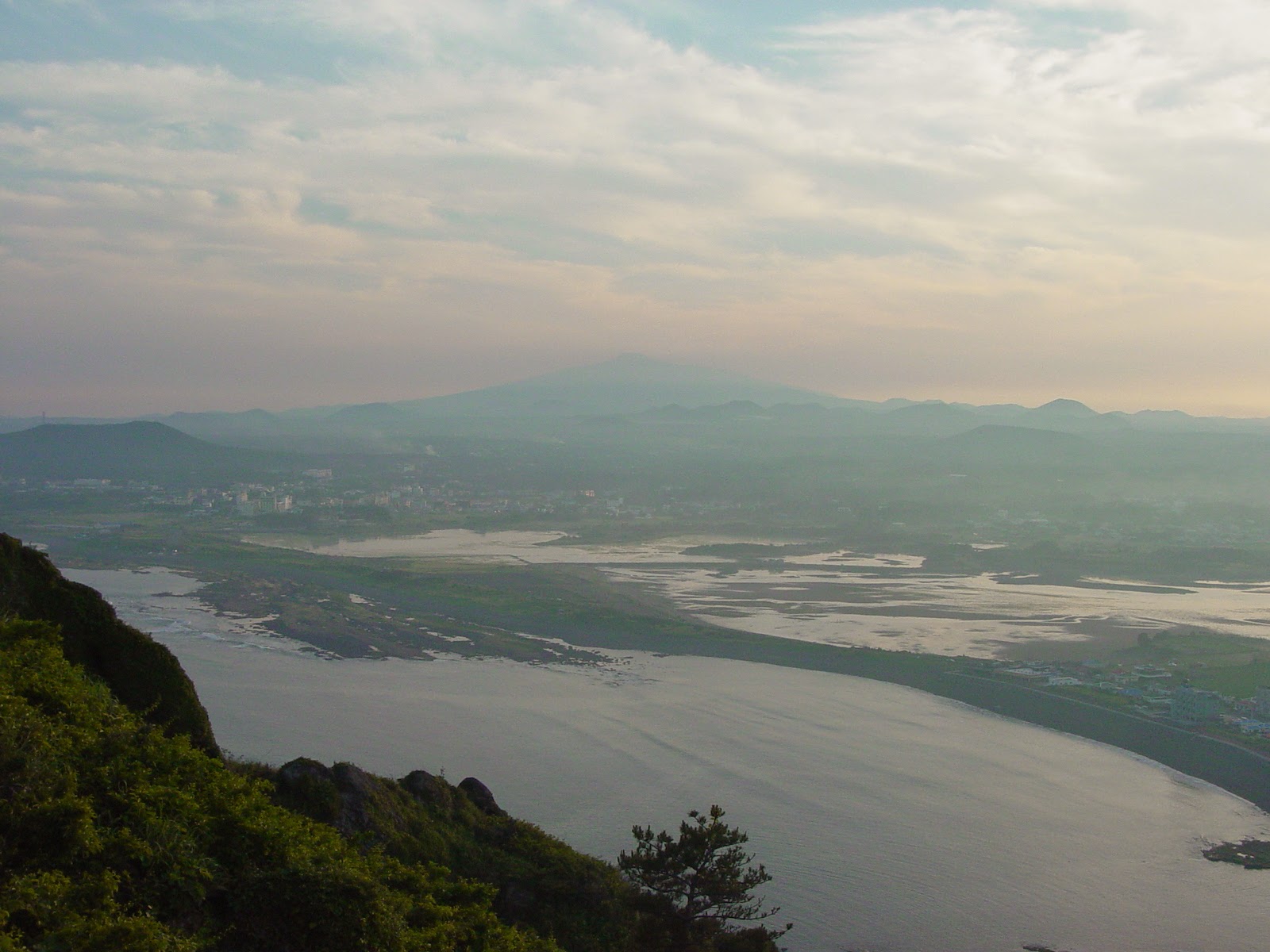
At the island's eastern point is the extinct volcanic plug, Ilchulbong, with Seongsan-ri Fortress at its base. 182m at the summit, the inside of the crater has been left to wild grass. The ground is so porous that any crater lake has drained away despite its punch-bowl shape. 20 minutes walk to the summit affords spectacular views back towards Jeju-do.
Port Seogwiko
Site 3: The Southern Coast
Seogwipo, Jeju's second biggest city, lies on a pretty harbor in the southern coast's subtropical zone of inlets and cliffs. A touristy town with several charming waterfalls nearby, there is good diving off the coast, as well as ballooning and the World Cup Stadium 6km west of town.
Cheonjeyeon Pokpo is a three-tier waterfall in a pretty gully near Seogwipo. The Seven Nymphs footbridge above, named for the seven carved beauties who served the Emperor of Heaven and supposedly slid down the moonbeams to bathe here every night.
Seven Nymphs Bridge
Chonjeyon Waterfall
Chonjeyon Waterfall
Jusangjeolli Rocks just south of the Convention Centre, are a 2km stretch of spectacular hexagonal-shaped-rock-strewn coastline. Made during the rapid cooling and contraction of lava when it hits the ocean, there are also waterfalls streaming off (such as the Chongbang falls pictured below) to increase its spectacle.
Chongbang Waterfall
Chongbang Waterfall
Rugged Rock of Chungmun
Harubang at the World Cup Stadium
Yongduam (Dragon Head Rock)
Woidolgoi Rock
Paengoktam Crater of Hallisan
Site 4: Hallasan
The central mountain, Hallasan (Mt. Halla) is South Korea's highest, and its national park has a unique range of flora and fauna in its four separate ecological zones that change with the seasons. It tends to collect clouds easily, so I didn't actually see it!
Paengoktam Crater of Hallisan
Five hundred disciples of Buddha. Yongsill rugged rock.
Flora of Mt. Halla seen from Songpanak
Other places on Jeju-do that I didn't make it to:
Moksogwan - just south of Jeju City, it has wood and stone installations
Fortress site of Nammun Gate in Songup Folk Village
Song-up Folk Village
Hallim Park entrance to Hyopchaegul Cave
Underground Pillar in Hallim Parrk
Spiritual Sanbangsan
- a sheer-sided rock on the southern coast
with a grotto temple and healing water
Source: Please note that the photos with the borders are taken from postcards. Lonely Planet Korea 7th Edition 2007

 The most famous view of Milford Sound, shown above, is of the steep-sided Mitre Peak (1962m, and actually five closely grouped peaks) sitting imposingly in the middle of the sound. However, this is only one view -- each direction is afforded spectacular views of snow-capped steep mountains, waterfalls, and deep green tanin-filled waterfall-fed ocean. It's impossible to see the open water of the Tasman Sea around the 16km of curves (and other mountains like the Elephant and the Lion), and the flat, calm waters bely its connection to the rough and windy western coast.
  The town of Milford (population 120) lies on a small area of marshy land at the head of the sound where the Cleddau, Tutoko and Arthur Rivers empty into the sea -- there is nowhere else the town really could be and it is one of the few sounds that has land suitable for a settlement. It includes an airstrip from which frequent scenic flights depart, a cruise terminal and jetty, and an old THC Hotel, but not really much else. Similar to Doubtful Sound (#729), its less famous neighbor, and the other 12 sounds, it is part of the Fjordland National Park and Te Waipounamu, the UNESCO World Heritage Site. However, it is the only sound in the park with road access for tourists.




.jpg)


.jpg)


